Quick Facts
- Fire Status: 100% Contained (145-acre Box Fire)
- District Status: Saguaro National Park East (Rincon Mountain District) is OPEN
- Impacted Areas: Tanque Verde Ridge, Loma Alta Trailhead, Juniper Basin
- Summer Entry Fee: $25 per vehicle (valid for seven days at both districts)
- Safety Mandate: Minimum 1 gallon of water per person, per day
- Peak Visitation: Early morning (5:00 AM – 9:00 AM) to avoid extreme heat
Saguaro National Park East remains open following the containment of the 145-acre Box Fire; however, travelers should verify specific trail closures at the Rincon Mountain Visitor Center due to lingering wildfire containment efforts and summer heat protocols. While the majority of the Rincon Mountain District is accessible, including the main paved loop, visiting safely this summer requires a clear understanding of current park alerts and the rugged landscape of the Arizona desert.
Box Fire Update: What is Open in the Rincon Mountain District?
Travelers planning a trip to the Tucson area should be aware of the recent shifts in park accessibility. The Box Fire, which ignited in the southeastern portion of the park, reached 100 percent containment on June 16, 2026, after burning a total of 145 acres in the park's official wilderness area. This incident serves as a significant reminder of the vulnerability of the Sonoran Desert ecosystem during the summer months.
The National Park Service alerts indicate that the 2026 Box Fire was caused by a paramotor crash in Box Canyon. This event led to the temporary closure of several key corridors. While the park is largely back to normal operations, specific saguaro national park east fire closures still affect certain backcountry routes. Currently, the Tanque Verde Ridge Trail and the Loma Alta Trailhead have experienced intermittent restrictions to allow for land recovery and further assessment by park specialists.
Statistically, fire pressure in the region has been mounting. In 2024, Arizona recorded 2,162 wildfires that burned approximately 282,000 acres, representing a 15 percent increase in fire frequency compared to the previous year. For the visitor, this means that wildfire containment status is now a permanent part of summer travel planning in the Rincon Mountain District. Always check for the latest National Park Service alerts before leaving your hotel, as trail statuses can change within a single afternoon due to wind or fire risk.
Saguaro National Park East vs West: Choosing Your Side
A common question for first-time visitors to Tucson is how to navigate the two distinct sections of the park. The Saguaro National Park East vs West comparison is not about which is better, but which fits your group’s physical ability and available time. The two districts are separated by roughly 30 miles and a 45- to 60-minute drive through the city of Tucson.
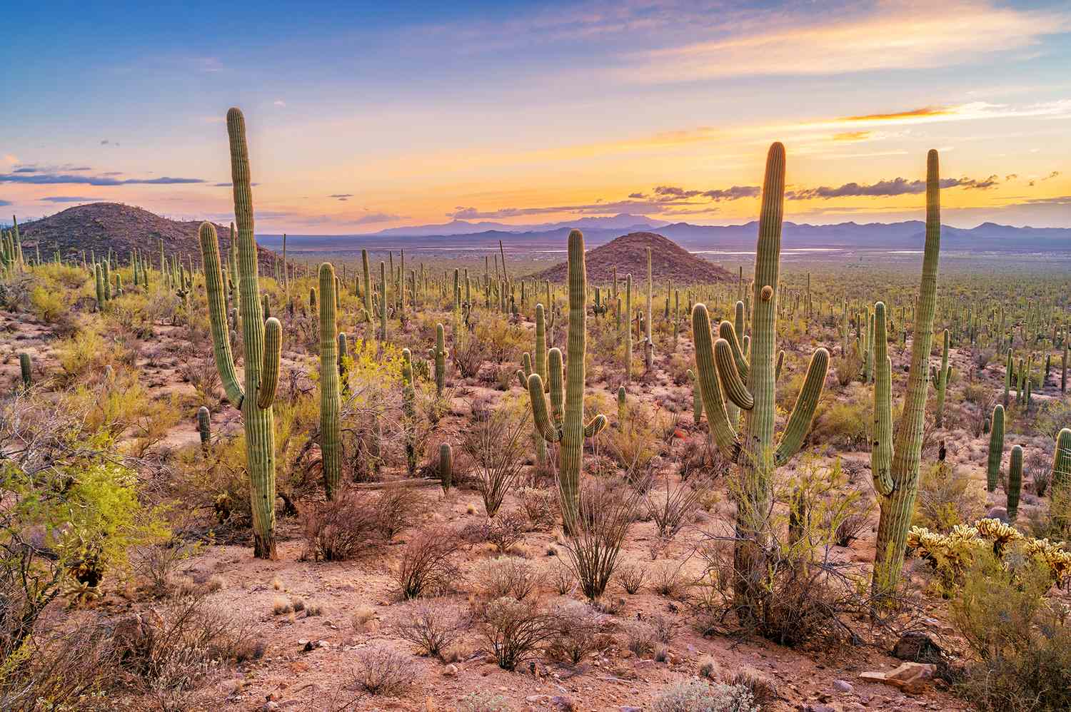
Saguaro National Park East, or the Rincon Mountain District, is known for its dramatic mountain backdrop and high-elevation wilderness. It offers a more remote, rugged feel. Conversely, Saguaro National Park West, or the Tucson Mountain District, is more popular for day-trip accessibility and features a higher density of the iconic saguaro cacti at lower elevations.
| Feature | Saguaro National Park East (Rincon Mountain) | Saguaro National Park West (Tucson Mountain) |
|---|---|---|
| Primary Drive | Cactus Forest Loop Drive (Paved) | Bajada Loop Drive (Gravel) |
| Landscape | Rugged, High Peaks, Oak Woodlands | Dense Cactus Forests, Volcanic Formations |
| Best For | Road Cycling, Long Hikes, Wilderness | Photography, Petroglyphs, Short Walks |
| Iconic Spot | Mica View Trail | Signal Hill Petroglyphs |
| Visitor Center | Rincon Mountain Visitor Center | Red Hills Visitor Center |
While both districts require the same entry fee, they offer vastly different experiences. The West side is home to the Signal Hill Petroglyphs and the Bajada Loop Drive, making it the preferred choice for those with limited time. However, the East side provides the Cactus Forest Loop Drive, a paved 8-mile scenic route that is world-renowned among cyclists and sunset photographers.
Essential Summer Safety in Saguaro National Park East
Summer safety in Saguaro National Park East is not a suggestion; it is a primary requirement for survival. Temperatures in the Rincon Mountain District regularly exceed 100 degrees Fahrenheit by mid-morning. Heat exhaustion prevention starts with timing. The park is most dangerous between 10:00 AM and 4:00 PM. High-level travel critics and park rangers alike advise visitors to complete all hiking activities by 9:00 AM.
The most critical safety mandate is the one-gallon rule: carry and consume at least one gallon of water per person, per day. Dehydration in the desert is rapid, and by the time you feel thirsty, you are already behind on hydration. Additionally, travelers must be aware of the desert monsoon season, which typically runs from June through September. These storms can cause sudden flash flooding and dangerous lightning.
Essential gear for summer safety in Saguaro National Park East include:
- Wide-brimmed hats and lightweight, long-sleeved UPF-rated clothing
- High-calorie snacks to replenish electrolytes
- A physical map, as cell service is unreliable in the wilderness areas
- Durable hiking boots, as the desert floor is home to cactus spines and rocky terrain
If you encounter signs of heat stroke—such as confusion, a lack of sweating, or nausea—seek shade immediately and prioritize cooling the body. The National Park Service alerts frequently highlight that rescue operations in the backcountry can take hours, making self-reliance and conservative planning your best defense.
Exploring the East Side: Cactus Forest Loop & Trails
For those who want to experience the park without committing to a multi-day trek, the Cactus Forest Loop Drive is the centerpiece of the Rincon Mountain District. This 8-mile ribbon of asphalt winds through a diverse desert landscape. It is a one-way road that offers numerous pull-outs for photography and short spur trails.
While some saguaro national park east side trails are currently under scrutiny following the Box Fire, several high-value options remain open. The Mica View Trail is an excellent, relatively flat option that provides stunning views of the Rincon Mountains and dense stands of saguaros. For a more immersive experience, the saguaro national park east loop (the Cactus Forest Trail) intersects the drive at several points, allowing hikers to customize the length of their walk.
Accessibility is a key advantage of the East side's infrastructure. The Rincon Mountain Visitor Center provides vital orientation, including interactive exhibits and a bookstore. Before you start your drive, stop here for saguaro national park east visitor center updates regarding trail conditions and any recent wildlife sightings. This is also where you can obtain backcountry hiking permits if you intend to camp in the Juniper Basin Campground or other remote sites—pending their current reopening status.
FAQ
Can you drive through Saguaro National Park East?
Yes, you can drive through the park’s main section via the Cactus Forest Loop Drive. It is an 8-mile, one-way paved road that offers exceptional views of the saguaro forest and the surrounding mountains. It is also a very popular route for road cyclists.
What is the difference between East and West saguaro park?
The main difference is the terrain and elevation. The East side is the Rincon Mountain District, which is larger, higher in elevation, and features more rugged wilderness. The West side is the Tucson Mountain District, which has a more concentrated forest of saguaro cacti and is generally more accessible for quick visits and photography.
Does Saguaro East have a visitor center?
Yes, Saguaro National Park East is home to the Rincon Mountain Visitor Center. It is located at the park entrance on Old Spanish Trail. It offers educational displays, park maps, and is the primary location for obtaining permits and checking on fire or trail closures.
What to do at Saguaro National Park East?
The most popular activities include driving or cycling the 8-mile Cactus Forest Loop Drive, hiking trails like Mica View or Desert Ecology Trail, and watching the sunset from the various overlooks along the loop. It is also one of the premier spots in the region for stargazing once the sun goes down.
National Park Service Resources
Maintaining safety and staying informed is the responsibility of every traveler. Before heading out, it is essential to check the official National Park Service (NPS) website for Saguaro National Park. This portal provides real-time information on drought levels, fire restrictions, and trail accessibility.
If you are planning to visit the backcountry, ensure your equipment is in peak condition and that you have notified a third party of your itinerary. For those interested in the post-fire recovery of the landscape, the visitor center often hosts seasonal talks on desert ecology and the impact of wildfire on the saguaro population. In the face of increasing fire frequency, your adherence to "Leave No Trace" principles and fire safety regulations ensures that this unique desert remains protected for future generations of hikers and nature lovers.